Gran Canaria Nov 2023
If you haven’t read any of our previous blogs for Gran Canaria, a quick intro on why it’s a great place for us to go cycling. Most of our cycling tours are in Mallorca and as an all-round package for road cycling options it’s hard to beat. Except for parts of the Winter months, when the weather can be unpredictable, very changeable and wet roads in Mallorca are rather slippery and best to be avoided! Rather than have the stress of what to do on these days, it’s easier to be someplace where it’s much less of a problem and that is the Canary Islands.
Gran Canary Terrain
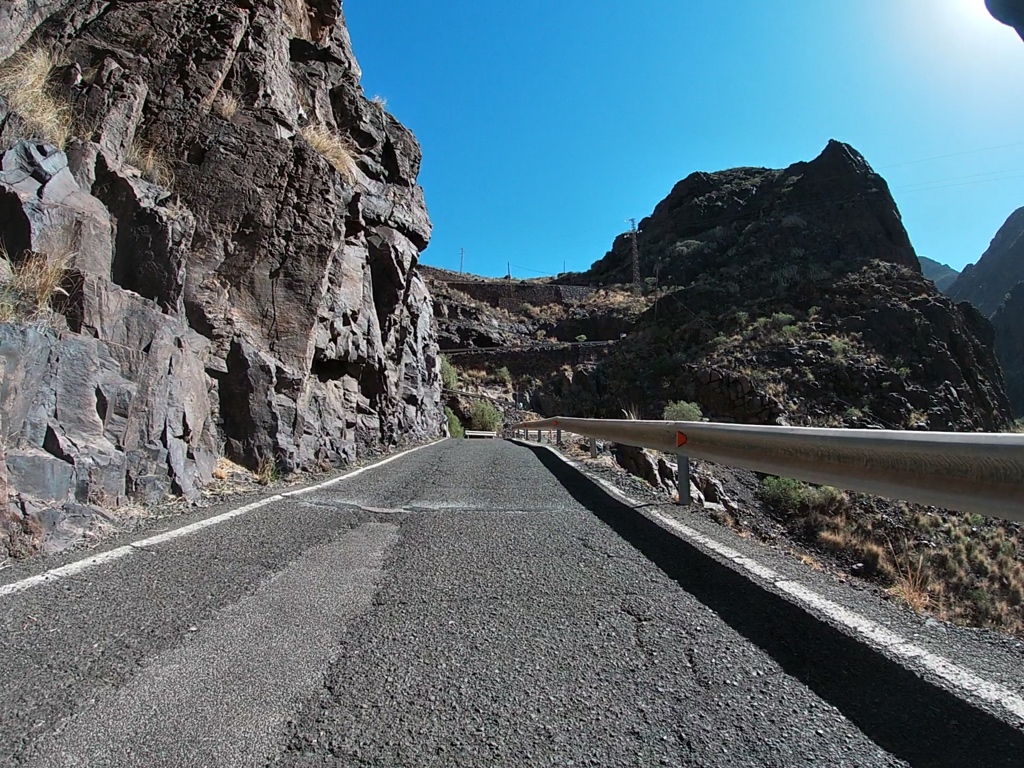
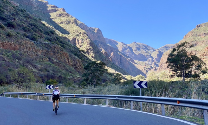
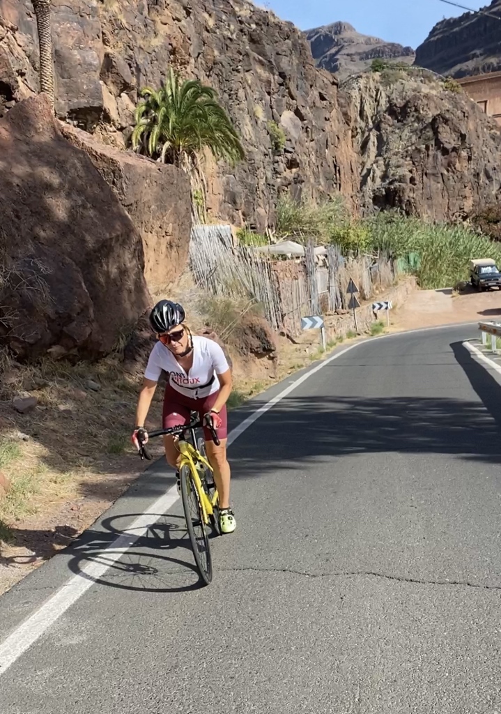
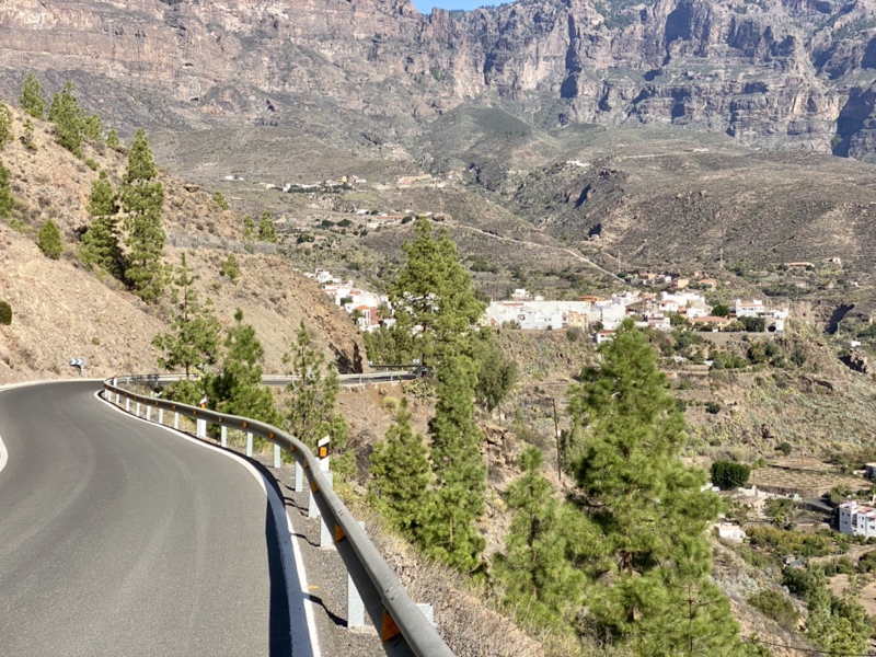
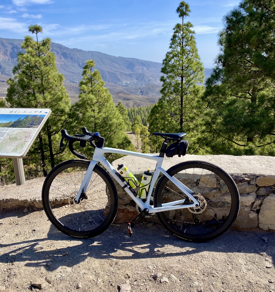
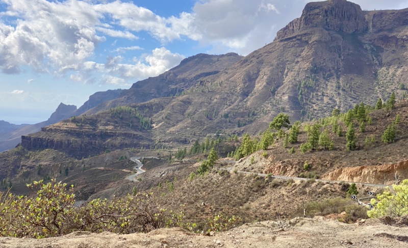
All the Canary Islands are pretty Mountainous and don’t have many flat roads, along with being generally quite windy! The highest peak for cycling on Gran Canaria, is the Pico de Las Nieves, which is around 1900m above sea level. Gradients, lots of 8-12%, with some 12-14% in small stretches. The most challenging route/climb is the ‘Valley of the Tears’, over on the west of the Island, although the road from Ingenio to Pico de las Nieves comes a close second. Recommended lowest gearing would be 34×34 or 34×36 if possible.
Location
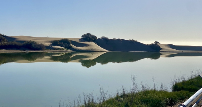
We like staying in Maspalomas/Playa del Ingles, it’s central South and only 25 mins by taxi from the Airport. This is quite a large town but has cycling friendly roads and connections, as well as lots of accommodation, a few bike rental shops, lots of Restaurants and a very long beach with a huge area of dunes. Most of the favourite bike routes are based around there, so it’s a good location for a bike trip.
GC Nov Ride 1 Las Filipinas
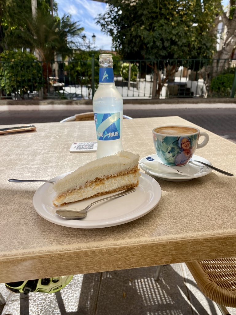
An easy cycle for the first day, no big climbs, stops for bike adjustments, getting ready for lots more bike rides! Along the coast in a westerly direction, plenty of up’s and down’s that require the small chainring. A right turn just before Arguineguin onto the GC-505. This is a fairly flat 1 or 2% gradual rise up to Cercados de Espinos, which is where we stopped at Bar Terraza Miguel for our first coffee & cake. Continuing through Las Filipinas would have meant starting to climb the Mountain towards Soria, so instead it was a simple retrace back to the start.
60km, 696m, 2:13, 26.6km/h, 35degC
GC Nov Ride 2 Doctoral, Santa Lucia, Bartolome, Fataga, Maspalomas
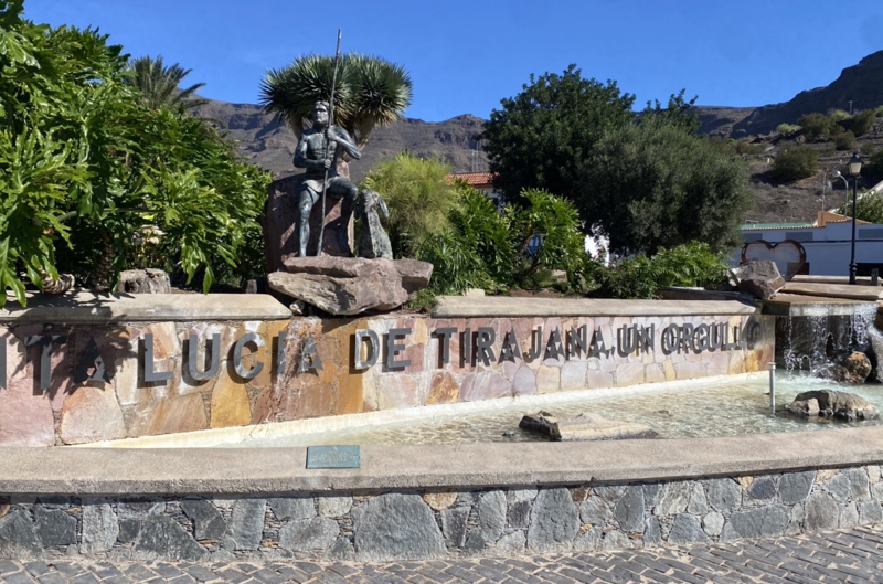
So today the fun sarts! Easterly along the coast to El Doctoral, a left turn and head towards the centre, climbing as you go! Fairly easy until past Sardina, then you get proper gradients. A short climb to join the GC-65 and then with a left, continuing the climb to the Mirador El Guriete, 560m elevation, about 30km into the route. Onwards to Santa Lucia, where we stopped for coffee & cake. From here the route is twisting and turning, some down, but mostly going up. A sharp left onto the GC-60 just before Bartolome and then with a few more bends you crest over the highest point of the day, just under 1000m elevation. As you descend down to Fataga, the views are breathtaking and with so many corners, the view constantly changes. Sadly, you can’t say it’s downhill all the way back because after the Camel Park, you have the 4km climb. On Strava “GC-60 Artedara Climb to Viewpoint”. In reality, it’s an up, down and up, with the last up being 1km and 130m of altitude gain. After that, enjoy the view of Maspalomas and the coast as you descend the last part back.
68km, 1378m, 3:14, 20.9 km/h 33degC

GC Nov Ride 3 Taurito & Back
With plans to ride the VOTT (Valley Of The Tears) in a few days, it was decided to have 2 easy days and today to check out if the road was still blocked leaving Taurito, from the landslide many years ago.
Easy spin westerly along the coast, passing some coastal holiday resorts until Taurito. The road was still blocked and after chatting with some locals we discovered that it’s unlikely to re-open anytime soon. It was decided a few years back that the hillside is not stable, so best to be avoided. That decided the route for VOTT, more climbing required to get there! We found the only place for a coffee, an arcade style place that served drinks but sadly, no cake! Don’t worry, that was rectified at the end of the ride in a superb ice-cream parlour that had everything!
64km, 899m, 2:41, 23.7 km/h, 30degC
GC Nov Ride 4 Rest Day – Maspalomas Lighthouse
Easy day, literally a loop around the local area. Chill out on the beach and a few bars.
20km, 147m, 1:00, 20.4 km/h
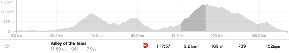
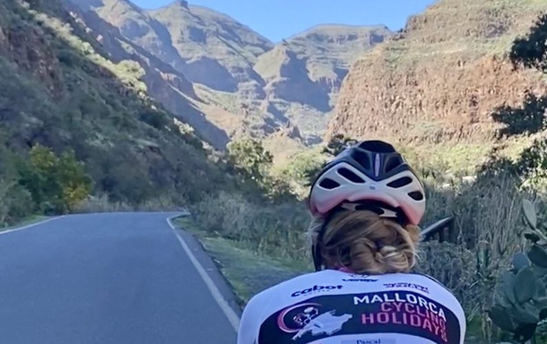
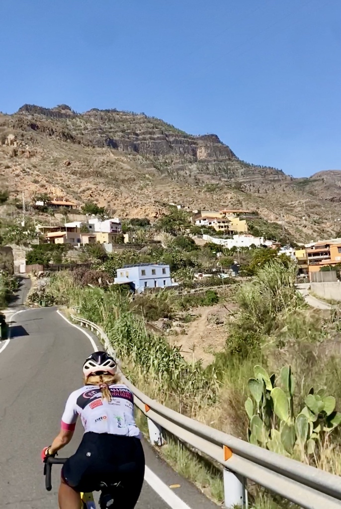
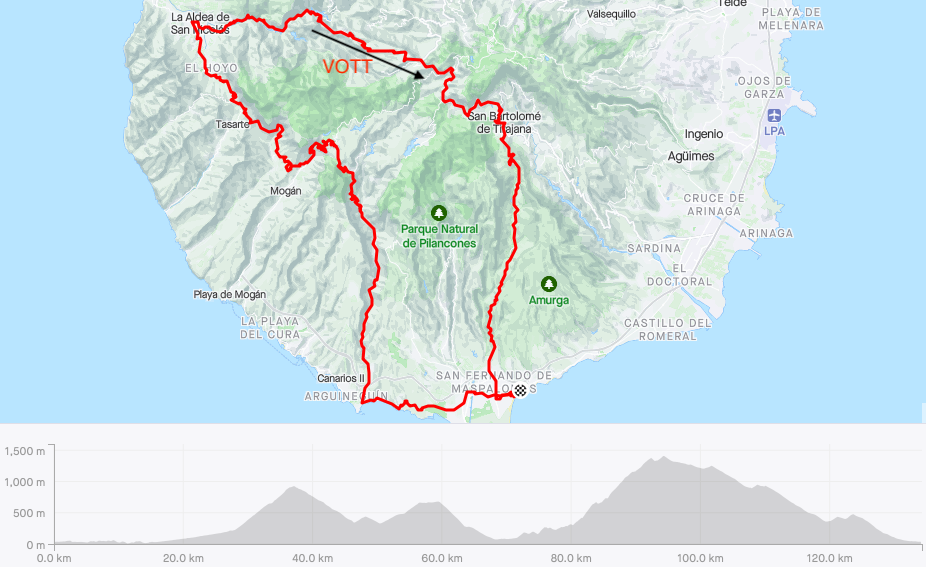
GC Nov Ride 5 Soria, San Nicolas, VOTT, Ayacata, Fataga
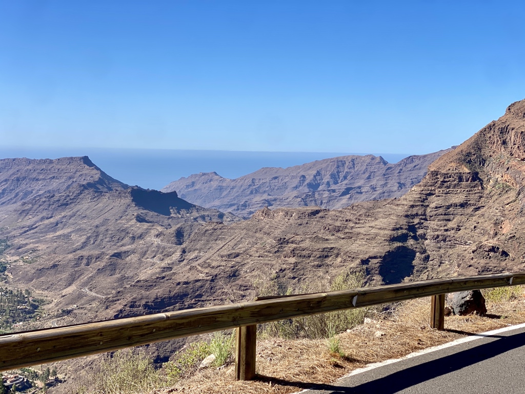
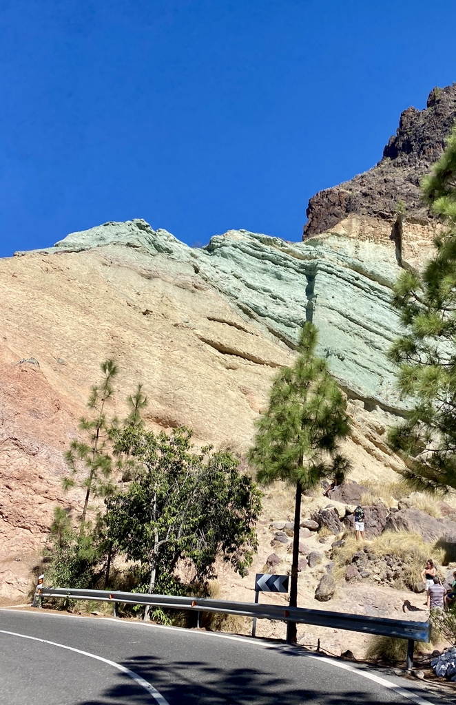
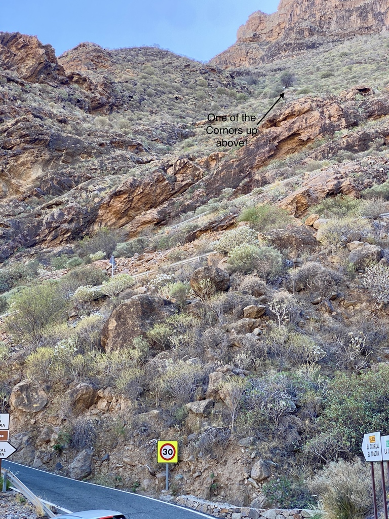
One of my hardest days on the bike! Similar to the Ventoux Cingles! As the road is closed from Taurito, to get past Mogan and head to San Nicolas, there are three options for the start of the ride. First is use a taxi boost to near Mogan. Second is to take one of the Ferries to Port Mogan. Third was my option, take the Soria climb and then head west (another climb) on the GC-605, until you join the GC-200 near Veneguera. This part of the route passes by the “Los Azulejos de Veneguera”, the Rainbow Rocks, they are quite spectacular! At La Aldea de San Nicolas de Tolentino (San Nicolas), you make a right turn and this is when you discover what your fitness level really is that day! I stopped here for a quick coffee, aquarius, a Toblerone (no cakes!) and topped up my bottles with water. I knew from here, there was nowhere to get water or food until Ayacata. Pretty much 30km with 1500m of ascent. The problem is the gradients and the surface in places. Lots of 13-16%, stretches of 17-18% and the peak was 21% on the Strava Segment Gc 606 Climb. Torture, at av 6.7km/h! Enough of the stats, the views and feelings are something else, difficult to put into words, however, the cycling name for the hardest stretch sums it up perfectly, “The Valley of the Tears”. The VOTT starts approx. 12km along the GC-210 after leaving San Nicolas and by then you have climbed another 450m, for me I was about 4hrs into the ride by now and a word of warning, ease off before the right hand turn onto the GC-606, on Strava, it’s called “The Wall”. This part has your breathing and heart rate at max but once the gradient eases, you know you have achieved something! From here there is generally more up but a few easier sections, amazing views if you can look! Towards the end of the GC-606, VOTT, behind you there is a fantastic view of Mount Teide on Tenerife! You also surreally pass a Goat farm over a 1000m up in the middle of nowhere! Finally you join the GC-60 and feel like you are back in the real world and you will again see other people! For that 30km stretch, I didn’t see a single cyclist and maybe 4 cars and a motorbike. I stopped in Ayacata for a Spanish Omelette, chatted to a group of cyclists and then headed back along the now familiar route of San Bartolome, Fataga and into Maspaloas. Not forgetting the 4km climb, finishing you off at the end of this route!
134.3km, 3536m, 6:26 (8:30 elapsed), 20.8 km/h, 30degC (20 min, 39 max)
Link to Relive of this ride: TBA
GC Nov Ride 6 Aguimes, Guayadeque, Caves, El Cardon, El Doctoral
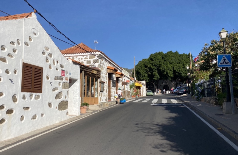
For the easy day after the monster day, more climbing! The Guayadeque Caves are really interesting and definitely worth the visit, as is the endless, pretty steep climb up there! The route out along the coast is usually a headwind to El Doctoral, then when you swing left inland, it slowly starts going up, so feels about the same! We tried a shortcut today to cut across to the GC-100 for Aguimes but part of it ended up being very stoney but rideable. Aguimes is very pretty and the small squares away from the routes through have interesting buildings, streets and things like a pretend Camel and Donkey that attract lots of attention. Plus they have a few cafes with great cakes! From here, you have to find the hidden GC-103 and then its 9km with 700m of climbing, av 7%, lots of 10-13%, some flashes of 17-19%. There are a few Restaurants at the top to rest and recover but you can rapidly cool down up there. Once descending, you realise and appreciate what you had achieved climbing up there! Today we decided on the SW GC-551 to take us across the quiet, pretty and undulating landscape to join the GC-65 and head back down to the coast at Vecindario. Then a retrace along the coast to finish.
80km 1600m 3:52 20.7 km/h 28degC

GC Nov Ride 7 Ayaguares, Monte Leon
Finally, an easier day! Well that was the plan, except we did the climb to Los Palmitos twice. This is a short route but has some great views and a reasonably flat valley leading up to the climb at Ayagaures by the Dam. Just before the climb there is a café and also just after starting to climb, another in Ayagaures village, usually with a few cyclists and walkers enjoying the views.
63.8km 1199m 2:57 21.6 km/h 29degC
GC Nov Ride 8 Fataga, Bartalome, Ayacata, Roque Nublo & Back
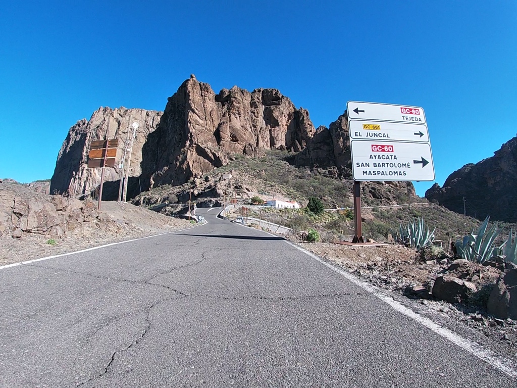
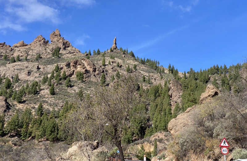
This may seem like a boring route, just uphill to Roque Nublo and then turning round and straight back down? However, it’s full of moments of “Look at that view!”. The hardest part is deciding where to stop for coffee as there are quite a few choices, all with their own uniqueness. During a holiday here, you must try them all at least once. Today it was a coffee stop at Bartolome and another just before Ayacata. The reason being to stay warm for the initial descending and not stopping at the higher altitudes, except for the photos and video clips. Climbing up this way before a U turn just past Roque Nublo at 1670m elevation, is just under 2000m of climbing from the sea level start over 46km. It’s very busy with walkers around Roque Nublo, take care on the way back down as they tend to just wander across the road between all the parked cars on both sides of the road! The “GC-600 Ayacata to viewpoint” segment is a tough one (2.5km and 290m up) but the views are superb and well worth the effort. Definitely not as cold descending, as doing this in February. Initially the road from Ayacata heading back to Bartolome feels pretty rough and bumpy in places but it’s not dangerous. Once below Bartolome, you can enjoy the smooth tarmac with the many twists, turns and fantastic views.
87km 2361m 4:17 20.3 km/h 27degC

GC Nov Ride 9 Fataga, Mirador, Santa Lucia, Doctoral
No surprises, another uphill start! Zuzana set off before me and we planned to meet at the Restaurant by the El Mirador de Tunte, 27km and 1000m of climbing. Here you can enjoy the peaceful surroundings with great views, across the canyons and spot where you are going next. Onwards from here was the sharp right onto the GC-65, heading to Santa Lucia de Tirajana. We had planned to take the GC-550, via Temisas to Aguimes but the sky went very dark and we took the shorter way, staying on the GC-65 down to Vecindario. Well more accurately, down after getting to the Mirador El Guriete. The road to there has a rather steep drop off on the righthand side, so I was not so happy! Once the drop didn’t look so scary, I could appreciate the views stretching to the coast. From Vecindario, it was then a pleasant tailwind back along the coastal GC-500 to Maspalomas.
67.4km, 1410m, 2:52, 23.3 km/h 25degC
GC Nov Ride 10 Soria & Back
Did Soria climb again today but with a nice coffee and cake in Soria village instead of carrying on climbing. Followed by the enjoyable and really stunning descent back the way we came. After an easy start along the coast, Zuzana urged me to carry on today when we reached the Soria climb. So after some video filming a few corners and a few pictures, I went back down to the bottom and then attacked the climb seeing as it would be downhill after the stop. Lots of fun, if you get the pace correct! It’s a 5.6km, 418m av 8.1% climb. At the top, you keep right through Barranquillo Andres, and as you pass the Dam, you are encouraged to “Make A Wish”, as that’s what’s painted on the Dam! After a few km, you find the Restaurant, that usually has a lot of bike riders, enjoying the chairs, sunshine and coffee. Once we felt recovered, it was a rapid descent back down, apart from the stop, where Zuzana wanted a video and photo taken, perched on some rocks that to me looked totally scary and I didn’t get too close! Apologies to the Movistar Pro who was swooping down the Mountainside, to find me in the middle of the road at that point! Back along the rather hilly (undulating doesn’t quite convey the gradients accurately) coast and that ended another really enjoyable bike ride.
77km 1310m 3:19 23.1 km/h 25degC
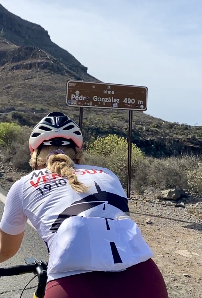
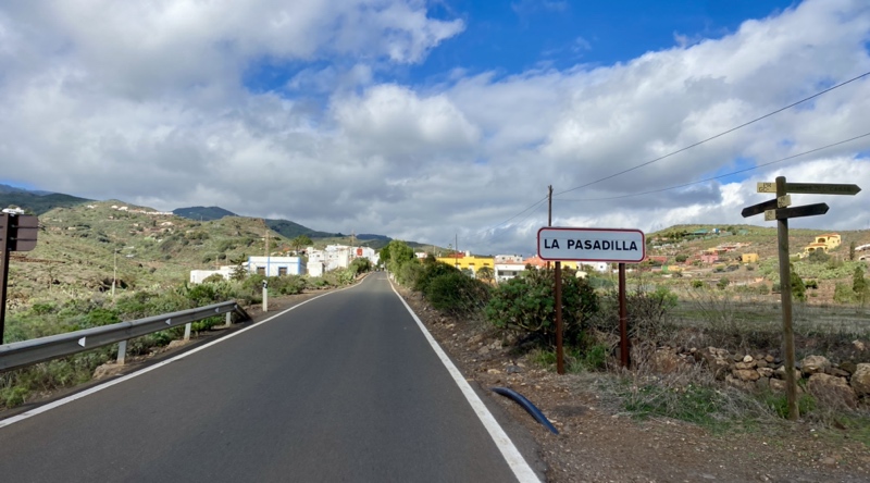
GC Nov Ride 11 Ingenio, Pasadillo, Cazadores, Pico de las Nieves, Ayacata, Fataga
The last day cycling for this trip, so it had to be another crazy day on the bike! With hindsight it might have been useful to have checked the climbing section of the route, to discover that it gets rather steep in places but then it wouldn’t have been such a surprise! The purpose of this route was that I wanted to go past the highest point, Pico de las Nieves but from the Eastward approach rather than repeating it from the Ayacata side. I just assumed, it can’t be any harder…. The start was easy, out along the coast around Vecindario, then climbing up to Aguimes on the GC-100. I couldn’t resist going into Aguimes, to one of our favourite cafes and enjoying a large cake with the coffee! With bottles topped up with water, it was onwards to Ingenio and then taking the left turn onto the GC-120 for Cazadores. Ouch, a sudden 10-11% upwards slope, followed by lots more climbing, 19.8km, 1452m at an av 7.2%. That doesn’t let you know that you will suffer to El Pasadilla, then after it, “GC 120 heavy climb”, it’s called, peaking a bit over 20%, with so much 17/18% along this part. Eventually, with your legs wasted, your lungs strained and feeling hungry and thirsty, as you couldn’t let go of the bars to get a bottle out, you reach the GC-130 at Cazadores. It was tempting to think of doing a u-turn at this point! Rapidly eat an oat bar, drink some more water and crack on with it! Only 9km more and 590m of climbing left to the top. From here it’s pretty quiet, I went through and then above the cloud layer and so at least it warmed up a bit as I got higher! The views were fantastic and the road surface couldn’t be faulted. I passed a white dome, the equivalent to Mallorcas Randa summit and it wasn’t much further to the high point. The top section of the route is through an area of forest, so different to the mostly dry and rocky terrain of the South of the Island. After the left turn onto the GC-600, to drop past Roque Nublo, the surface changes to a rough and cracked road, so not quite so comfortable but the views make up for it, although you don’t want to stop anywhere, as in the minimal cycling clothing, it is rather cold up here, even after putting on a windproof jacket, I think next time, something thicker or another thin base layer would be better. No stopping at Ayacata, I wanted to get down to the lower altitudes and warmth. So GC-60 across to La Plata, past the Cruz Grande viewpoint and down through San Bartolome for a quick stop in Fataga. Water and a cereal bar, I did want a cake and coffee but the service was not so good today, so back on the bike and get back to recover! Tackle the 4km climb on the way down to Maspalomas and then suddenly, it’s all over. Every bike ride was fun, all different and so rewarding. A great place to cycle and you certainly can’t get unfit here!
101.4km, 2520m, 4:41, 21.6 km/h, 20degC. Max Elevation 1860m, Elapsed time 5:33


Last Day
Travel day, so no bikes today, beach stroll, remembering all the amazing bike rides of the last few weeks!
Summary
The first thought is “Wow!” So much fun cycling here, in November. Amazing scenery, testing but enjoyable terrain, quiet but friendly motorists when you encounter them. You definitely have to pace yourself, or suffer the consequences after a few rides. The places we stayed in had excellent variety and quality of food at meals times. Less places for a coffee stop than in Mallorca, it’s worth knowing where to stop before you set off. Very low gears are essential, as are good brakes!
For more about these rides, check out our FaceBook, Instagram and YouTube channel pages.
Table of Routes and links to the Strava activities.
| Ride / Route | Strava Link |
| Las Filipinas & Back | https://www.strava.com/activities/10223051758 |
| Vecindario, Santa Lucia, Fataga | https://www.strava.com/activities/10228710206 |
| Taurito & Back | https://www.strava.com/activities/10233584324 |
| Lighthouse | https://www.strava.com/activities/10239944010 |
| Soria, Nicolas, VOTT, Ayacata, Fataga | https://www.strava.com/activities/10247435051 |
| Aguimes, Guayadeque Caves, Doctoral | https://www.strava.com/activities/10251429681 |
| Ayagaures, Montana la Data | https://www.strava.com/activities/10262892965 |
| Fataga, Roque Nublo & Back | https://www.strava.com/activities/10268840074 |
| Fataga, Santa Lucia, El Doctoral | https://www.strava.com/activities/10279002300 |
| Soria & Back | https://www.strava.com/activities/10285056547 |
| Vecindario, Ingenio, Cazadores, Pico de las Nieves, Ayacata, Fataga | https://www.strava.com/activities/10290125518 |
| Aguimes, Santa Lucia, Bartolome, Fataga | https://www.strava.com/activities/8544065526 |
| Espino, Ayacata, Fataga | https://www.strava.com/activities/8549828870 |